Random Links, toys and free location data

Over the last day I have learned about some (more) interesting things out there – here are some to share with you:

Exporting your cars information to the mobile phone

In our user interface engineering class one of the tasks in the exercise is to create a concept design for providing information from the car on the mobile phone (e.g. millage, amount a fuel in the car, next service date, alram status, etc). The first part is to assess what information could be made accessible and what value it would create for the user. 
Today I came across a device (Tyredog TD-1000A) that is concerned with a one sub-part of this scenario: checking your pressure in the tires of the car. It is a simple sensor system, screwed on to each of the tires, connected to a wireless receiver. There is also a version that includes features for the car alarm (Tyredog TD-3000A).
Another group is looking yet again into the domain of  restaurant finders or more general night life. Apropos restaurant finders, Saturday night we got out of the subway onto union square and discussed where to go for dinner (an we probably looked disoriented). A local lady stoped and recommended the Union Square Café – and it was just great… sometimes just talking to someone in the street may provide you with an excellent alternative to technologies 😉 Perhaps the students find a solution that can reflect personal recommendations well…

GPS monitoring for car insurance

In my talk at ISUVR2008 I referred to an example where an insurance is monitor driving behavior and makes a tariff according to this. Some people asked me for more details and
references, here they are…

My example was based on the pilot announced from the German insurance WGV. They planned to run a pilot with 1500 people using a GPS based monitoring devices. The box is mounted in the car and compares the current speed with the allowed speed limit and warns to reduce speed (if over the limit). If the driver is more than 12 times per year over the speed limit (basically ignoring the warning) he does not get the reduced rate. (see http://www.wgv-online.de/docs/youngandsafe.pdf – in German only). In the announcement it said they will run the pilot to 2009…

There are different ideas how to take GPS driving monitoring beyond the lab, e.g. in 2007 Royal & SunAlliance announced a GPS-based eco car insurance and the AIG a Teen GPS Program – targeted at parents.

Looking at different comments (on news pages and in blogs) it seems that people’s opinions are very split…

Integration of Location into Photos, Tangible Interaction

Recently I came across a device that tracks the GPS position and has additionally a card reader (http://photofinder.atpinc.com/). If you plug in a card with photos it will integrate location data into the jpgs using time as common reference.

It is a further interesting example where software moves away from the generic computer/PC (where such programs that use a GPS track an combine it with photos are available, e.g. GPS photo linker) into a appliance and hence the usage complexity (on principle, did not try it out so far this specific device so far) can be massively reduced and the usability can be increased. See the simple analysis:

Tangible Interaction using the appliance:

  • buying the device
  • plug-in a card
  • wait till it is ready

vs.

GUI Interaction:

  • starting a PC
  • buy/download the application
  • install the application
  • finding an application
  • locating the images in a folder
  • locating the GPS track in a folder
  • wait till it is ready

.. could become one of my future examples where tangible UIs work 😉

Visual aid for navigation – using human image processing

While browsing the equator website I came again across an interesting publication – I had seen two years ago at MobileHCI – in the domain of pedestrian navigation [1]. The Basic idea is to use a collection of geo-tagged photos to provide visual cues to people in what direction they should go, e.g. “walk towards this building”. This is an interesting application linking two concepts we discussed in the part on location in my lecture on pervasive computing. It follows the approach of augmenting the user in a way that the user does what he does well (e.g. matching visual images) and the computer what it does well (e.g. acquiring GPS location, finding pictures related to a location in a DB).

[1] Beeharee, A. K. and Steed, A. 2006. A natural wayfinding exploiting photos in pedestrian navigation systems. In Proceedings of the 8th Conference on Human-Computer interaction with Mobile Devices and Services (Helsinki, Finland, September 12 – 15, 2006). MobileHCI ’06, vol. 159. ACM, New York, NY, 81-88. DOI= http://doi.acm.org/10.1145/1152215.1152233

Poor man’s location awareness

Over the last day I have experienced that very basic location information in the display can already provide a benefit to the user. Being the first time in Sydney I realized that network information of my GSM-phone is very reliable to tell me when to get off the bus – obviously it is not fine grain location information but so far always walking distance. At some locations (such as Bondi beach) visual pattern matching works very well, too 😉 And when to get off the bus seems a concern to many people (just extrapolating from the small sample I had over the last days…).

In my pervasive computing class, which I currently teach, we covered recently different aspects of location based systems – by the way a good starting point on the topic is [1] and [2]. At We discussed issues related to visual pattern matching – and when looking at the skyline of Sydney one becomes very quickly aware of the potential of this approach (especially with all the tagged pictures on flickr) but at the same time the complexity of matching from arbitrary locations becomes apparent.

Location awareness offers many interesting questions and challenging problems – looks like there are ideas for project and thesis topics, e.g. how semantic location information (even of lower quality) can be beneficial to users or finger printing based on radio/TV broadcast information.

[1] J. Hightower and G. Borriello. Location systems for ubiquitous computing. IEEE Computer, 34(8):57–66, Aug. 2001. http://www.intel-research.net/seattle/pubs/062120021154_45.pdf

[2] Jeffrey Hightower and Gaetano Borriello. Location Sensing Techniques. UW-CSE-01-07-01.

UbiLog Workshop in Bremen

This afternoon our UbiLog workshop was held in Bremen as part of the Informatik 2007 conference. We selected 4 papers for presentation and had a lively and interesting discussion.

Following the talk of Nikolai Krambrock we discussed the use context, and in particular location, to restrict or allow access to information. My favourite example is an online-banking appliance that only works in predefined areas (e.g. at home and in my car). Using context appears one option in creating human understandable solutions for secure systems. People have developed means to protect physical objects and valuable, perhaps we should draw more on this experience in the design of secure systems.

bi-t Student demo lab results at Fraunhofer IAIS

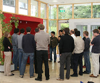
This morning we presented selected demos of the lab on location and context awareness to people at the Fraunhofer IAIS. Besides the fact that our main infrastructure component (the Ubisense indoor system) did not work the demos went well. It was very strange – the infrastructure worked for the last 6 weeks (including several reboots) and this morning after rebooting the server it did not find the sensors anymore for several hours.

The majority of demos were based on the second assignment which was to create a novel application that makes use of an indoor location system. The applications implemented by the students included a heat-map (showing where a room is mainly used), co-location depended displays (enabling minimal setup effort and admin effort), museum information system (time and location depend display of different levels of information), and a security system (allowing a functionality only inside a perimeter dynamically defined by tags). Overall it was very interesting what the students created in 4 weeks of hard work.

We also briefly showed the location post its which were based on GPS and were done for the first group assignment, the CardioViz prototype (from the lab in the winter term), and the Web annotation tool that is now nearly ready.

Even though there were some difficulties in running some of the demos I am still convinced in a research environment we need to show live demos and not just ppt-slide-ware 😉 We probably have to demo more to get more professional with non-working components.

More pictures are online at http://foto.ubisys.org/iais_presentation/

Visiting the pervasive computing labs @ Johannes Kepler University in Linz


It is always great to visit the pervasive computing labs in Linz – always new and cool research to see. Looking at my my Google News-Alert it seems that the term “pervasive” is dominate by Alois 🙂

Alois Ferscha showed me their interaction cube. It is a really interesting piece of research and the background and argument of the cinematic of the hand shows a deep insight. There are some slides on the Telekom Austria Cube that are worthwhile to look at. It is interesting that he has gone successfully the full cycle from concept to product (image is taken from the slide show).

We talked about location systems and what options are available on the market. In Linz they have one room where they have high accuracy tracking based on an array of InterSense systems. Our experience in Bonn with the ubisense system has been mixed so far. Perhaps there are different technologies to come (or we have to develop them).

PhD defence of Mario Pichler in Linz

This Morning Mario Pichler defended his PhD dissertation at the Johannes Kepler University in Linz. One central theme he investigated in his research was how innovation happens between technology push and application/market pull. It is scientifically a very interesting argument when looking at applied research. However considering successful products, especially products from Asia and in particular Korea, it appears that focusing on technology innovation can be a strong and successful strategy.

In the ubicomp community it seems that technology driven projects are seen very critical and that there seems to be a need to justify ubicomp research with applications. The arguments for it is simple – if we let technology drive development we end up with things nobody needs. But I am less and less believing in this argument – many of the things we use daily (phone, SMS, internet, cars) are there because technology has created the need and we did not really need them. Obviously there is a need for communication, entertainment and mobility but this is abstract and the concrete technologies used are not easy to be directly deduce from them.

In Austria they have a general exam as part of the PhD viva. I learnd something about the history of the term dead reckoning (see http://en.wikipedia.org/wiki/Dead_reckoning for a discussion on the Etymology of the term).

Ubisense system at IAIS used in the lab

During our lab on context- and location-aware systems we have currently one task to create a novel application using the Ubisense indoor location system. We have set up a little server in C# that reads out the tag-ids and the current x,y,z coordinates and multi-casts it via UDP to several clients.

The students have to create an application that reads the tags and their locations from UDP and make use of it. One first interesting result was a heat-map, that would allow to map out the usage of the room. By the end of term we hope to have a nice set of applications.

For many students it was the first time at the Fraunhofer lab and hence they found interesting things to play with. E.g. Diana explored the PointScreen , a system developed in the division Virtual Environments at Fraunhofer IAIS. Further reading on the point screen:
Li et al. Gesture Frame – a Screen Navigation System for Interactive Multimedia and Strauss et al. : Information Jukebox – A semi-public device for presenting multimedia
information content
(2003).